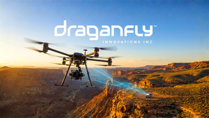
Huntsville, AL, July 14, 2025 (GLOBE NEWSWIRE) -- GeoCue, a leading provider of TrueView 3D LiDAR mapping sensors and LP360 processing software, officially welcomes Unmanned Vehicle Technologies (UVT) into its growing network of distribution partners. Based in the U.S. and trusted nationwide, UVT brings with it a customer base that’s mission-driven, tech-forward, and increasingly reliant on LiDAR for applications that go far beyond traditional surveying.
Some partnerships are born out of opportunity. Others out of necessity. This one? It’s about timing, alignment, and a shared commitment to giving professionals the tools they need to get the job done right; it’s a strategic alignment designed to fill a gap and spark new possibilities.
“GeoCue builds tools that work where it counts: in the field,” said Chris Fink, Founder & CEO of UVT. “That’s exactly the kind of reliability our customers expect. They don't have time to figure outcomplicated workflows or unreliable hardware. This collaboration gives us another dependable, scalable solution to keep our customers operational and ‘Always On.’”
Founded in 2014, UVT has built a reputation for delivering advanced drone and robotics solutions across industries ranging from public safety to utilities, infrastructure, and enterprise security. Their formula? Listen first, then provide solutions tailored to the mission. And now, with TrueView LiDAR and LP360 in their offering, they’re bringing powerful 3D mapping into the hands of professionals who need data they can trust—fast.
“UVT brings something rare to the table: a deep understanding of what it means to operate when it matters most,” said Miles Kelly, Sales Manager at GeoCue. “They’re not just selling hardware. They enable operational success across sectors like public safety, critical infrastructure, inspection, and search and rescue. That’s where we see TrueView LiDAR and LP360 software making a difference, unlocking new use cases and elevating what's possible.”
The timing couldn’t be better. As more agencies and enterprises look to integrate advanced mapping into their workflows, the demand for intuitive, reliable LiDAR solutions is surging. GeoCue’s TrueView 3D imaging sensors—like the 655 and 535—paired with LP360’s streamlined data processing capabilities, deliver the performance professionals need.
And UVT is ready to deliver. From hands-on consultation and BVLOS expertise to cUAS monitoring and docked drone deployments, UVT’s clients already trust them to solve their toughest aerial challenges. With GeoCue now in their toolkit, they can extend that support into the world of precision mapping—reaching surveying firms, utility providers, infrastructure managers, and public works teams, plus emerging sectors like emergency response and disaster preparedness.
“This partnership expands the LiDAR solutions we’re able to offer and adds even more capability for the mission-driven teams we support,” Fink added. “We’re looking forward to supporting our customer base, adapting our offerings, and exploring what’s next—together.”
With UVT now onboard, GeoCue’s distribution footprint becomes not just broader—but deeper, stronger, and more capable of reaching new markets with real-world impact.
About UVT:
Unmanned Vehicle Technologies (UVT) is North America's leading drone and robotics integrator, delivering end-to-end operations planning, implementation, support, and problem-solving to keep organizations Always On. We equip enterprise and public safety teams with fully integrated docked drone solutions, real-time remote operations, and cUAS expertise to enhance security, inspections, and situational awareness. Our mission-critical services include fleet consultation, seamless hardware and software integration, BVLOS enablement, and regulatory compliance—all backed by our global security operations center, where trained remote pilots stand ready to operate your docked drone fleet on demand.
To learn more about UVT visit: www.uvt.us
About GeoCue:
GeoCue brings geospatial experts the very best in drone, mobile and land surveying equipment, geospatial point cloud software, workflow, training, and support for high-accuracy LiDAR and Imagery mapping to help civil engineering and surveying professionals achieve successful data collection, processing, and management.
With TrueView LiDAR/Imaging sensors and LP360 point cloud data processing software, we are the leader in LiDAR mapping processing in North America able to meet customers where they are in terms of technology, adoption, budget, and resources.
To learn more about GeoCue, visit www.geocue.com.
Attachment

Bret Burghdurf
GeoCue
1-256-461-8289
bret.burghdurf@group-md.com